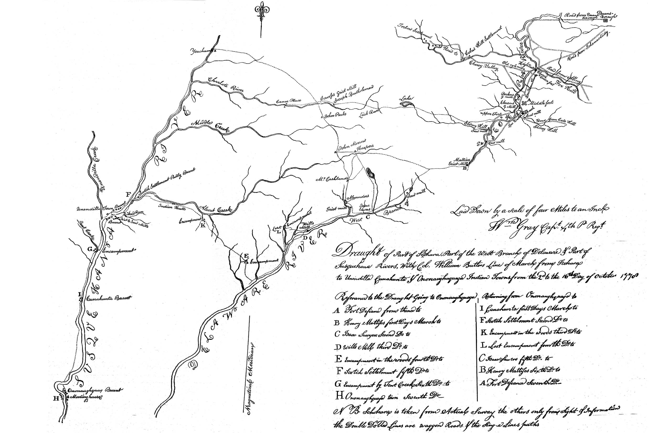
William Gray's Map of the Sullivan Expedition

This map identified both Harpersfield (Harper's) and it's relationship to the forts in the Schoharie Valley, but also identified the location of the Bartholomew's on the Charlotte. It becomes obvious that the path north from Harpersfield to Cherry Valley goes right past the Bartholomew cabin. The Bartholomew's had moved up from New Jersey in 1770. It is easy to see how Alexander Harper met Elizabeth Bartholomew during his travels from Cherry Valley to Harpersfield. |
 BACK
BACK