

1768 Lot Pejopscot Proprietors Lot Map of Topsham, Maine
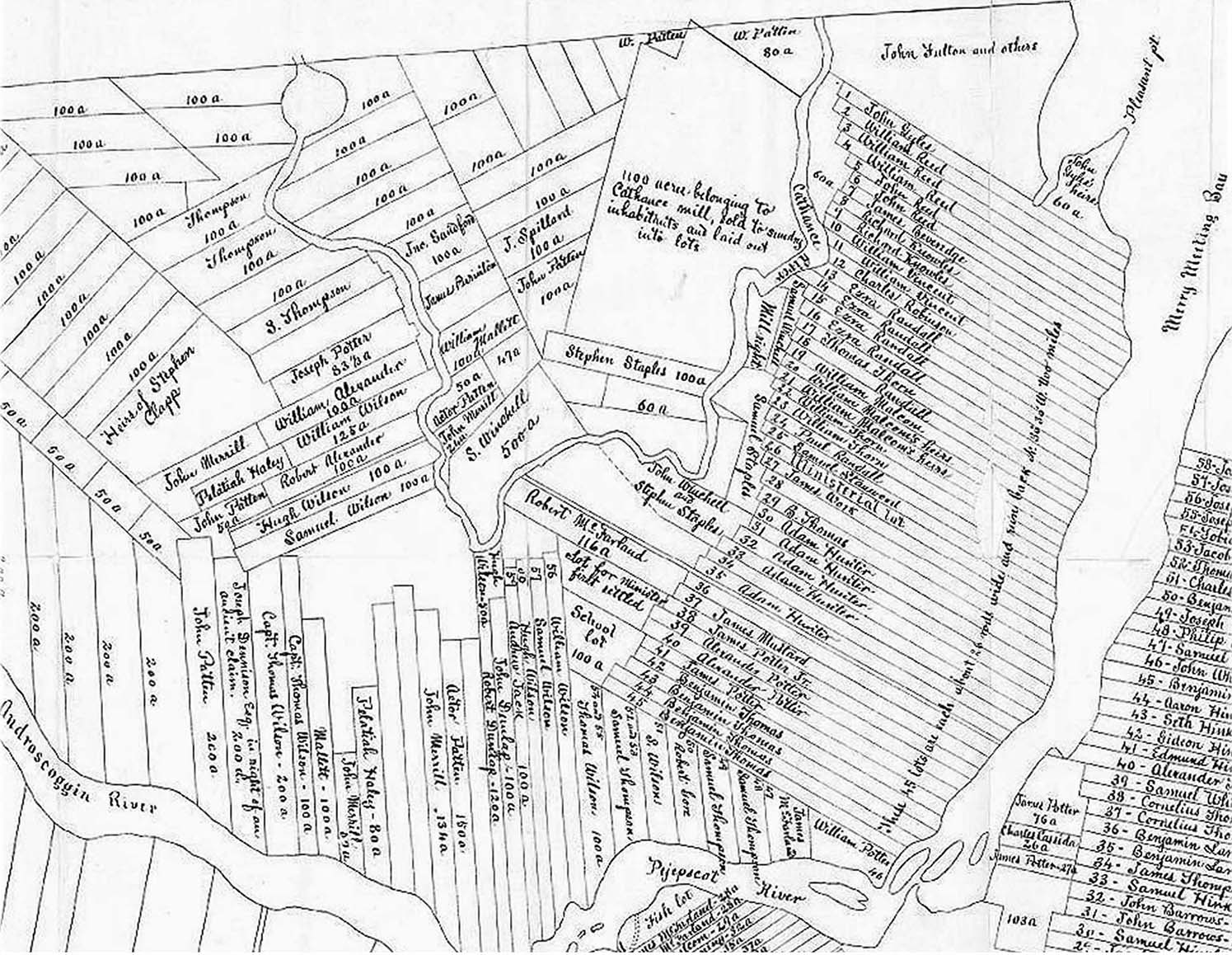
The lots shown partially on this map on the bottom and lower right side were located in Brunswick. The two towns were separated by the river. John Gyles (Topsham Lot #1) was a Captain in the local Militia and was given responsibility to build a stone fort in Brunswick at the foot of the falls.
This map of the lots in Topsham was created in 1768 for the Proprietors. Topsham is north of the Pejepscot and Androscoggin Rivers. The location of the Harper Lots in Topsham are shown as the long narrow lots numbers 25, 31, 32 and 34. The person signing up for Lot 33 remains a mystery. These were 100 acre lots on average and were sold in the early 1720's for 5£ plus a commitment to build a perminent house within 3 years. James and his family elected to Forfiet their lots and move to Boston.
James Miller ? Lot 33
Joseph Harper Lot 32 Burried in Melrose Cemetery
William Harper Lot 31
Pd Moses Harper ? Lot 25
Images copyright 1998, 1999, 2000, 2001, 2002, 2003, 2004, 2005, 2006, 2007, 2008, 2009, 2010, 2011, 2012, 2013
All rights reserved