| |
|
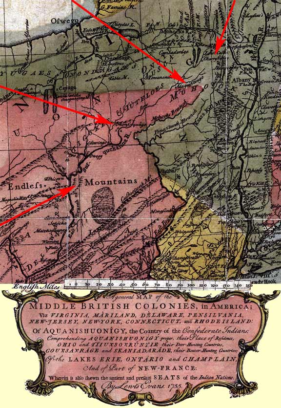
Portion
of Lewis Evans Map
of the Middle British Colonies
Published in Philadelphia in 1755 and based on information
through 1753. |
| |
This
map was published the year after the family moved to Cherry Valley from
East Windsor, Connecticut. Note below the location of Cherry Valley in
relation to Albany. The rose colored area is land claimed by the
Colony of Pennsylvania. Note it includes a portion of the area where
Harpersfield, New York will be 15 years later. Also shown is the
location of the Ononequâgo
Indian village. These were the peoples whom John Harper Sr. would
negotiate with for purchase, under the name of King George III,
for 250,000 acres. Harpersfield would would be formed from the
Northeast
22,000 acres of this purchase.
|
| |
Eventual location of Harpersfield, NY |
Cherry Valley identified |
Ononequâgo village
identified
(in 1767 John Harper Sr. would negotiate with this tribe for land which
would eventually include Harpersfield, NY) |
|
Rose colored area depicts land claimed by William Penn for
Pennsylvania.
|
|
|
|
|
 |
This site
maintained by Rick Harper
Images copyright 1998, 1999, 2000, 2001, 2002, 2003, 2004, 2005, 2006
All rights reserved |